Researcher Marko Kallio recognized by UK prize for his map of the Mekong River

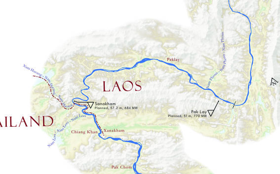
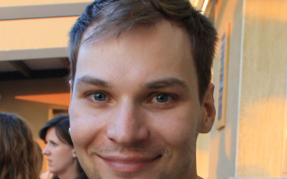
Aalto University researcher Marko Kallio was given not one, but two prizes by the British Cartographic Society last week. Kallio’s ribbon map of the Mekong River won not only the Avenza Award for best electronic mapping, but also this year’s prestigious top prize, chosen from the winners of all competition categories.
The winning map – or rather, according to Kallio, a narrative adventure through the entire Mekong River – measures 6.5 metres long and 40 centimetres wide. It is lined with texts that tell the story of the river's varied regions, not just of geography but also of history and culture, for example.
‘The map is a combination of things that interest me about the Mekong. Some of it has come from my own travels, some from collaborations with historians and archaeologists at the University of Helsinki, and some from my own research,’ says Kallio, a postdoctoral researcher from the School of Engineering at Aalto University.
In his research, Kallio is developing a range of methods for environmental modelling, to provide more reliable information about the hydrological environment – in this case, of the Mekong region.
‘The Mekong region has relatively little open measurement data, and the quality varies. Most of the data is based on modelling, which in turn has various uncertainties. I am developing methods to make the results of these models more reliable,’ he explains.

The winning map is not directly related to any single study: the Mekong River, one of the world's largest rivers at more than 4,000 kilometres long and flowing through six countries, is the focus of Kallio’s research in general – and has been since the first research project in 2013.
Kallio says that he chose the Mekong as a research topic by chance, as he happened to hear about a hydrological modelling project in Laos while studying environmental engineering at Metropolia School of Applied Sciences. He then contacted Juha Sarkkula and Jorma Koponen about the project and the rest is history. Collaboration with them has continued even beyond this first encounter.
‘Since then, little by little, both my knowledge and interest in the Mekong region has deepened,’ Kallio says.
Perhaps the most remarkable thing about Kallio’s success in the international competition for cartographers is the fact that the focus of his research is not even on maps; in his own words, cartography is more of a “side project” and hobby, although he has studied cartography as a part of his master’s degree in geoinformatics. Winning an international, prestigious award is still, of course, a very satisfying event.
‘I was very surprised to win – but of course also very happy. Every year, some of the world’s top cartographers enter the competition,’ says Kallio.
Completely new method for making ribbon maps
The Mekong River is of course not as straight as Kallio’s metres-long work suggests. In order to fit the entire twisting and turning river on the ribbon map, Kallio had to cut, turn and shift the course of the river at certain bends, creating errors in the geography of the area. This required the development of a new method to make the inconsistent geographic information resulting from the turning and shifting as realistic as possible.
‘Ribbon maps have been made since at least the 17th century, but I have never seen one where the elevation model, be it a road or a river, follows along,’ Kallio says.
Kallio suspects that this new method of making ribbon maps could be one of the reasons why the British Cartographic Society awarded him the main prize – an earlier version without the elevation model was selected for competition at an international cartographic conference, but it wasn’t victorious.
However, making ribbon maps that not only look as natural as possible, but are also faithful to the real geography, still requires development – and the researcher, despite the awards, is not going to rest on his laurels.
‘I have already received good feedback and suggestions for improvement from other cartographers since winning. There are also a lot of things in the map that I didn't quite manage to do as I had imagined beforehand. So, there is still a lot for me to learn in cartography,’ Kallio says.
The long-established British Cartographic Society is the UK’s national body promoting cartography and the use of geographic information. The annual map competition is an open, international competition for maps published in different parts of the world during the year – last year's winners, for example, depicted the city of Shanghai on a variety of maps.
Dr. Kallio himself was unable to attend the awards ceremony held in the UK last week. The award criteria and the comments from the judges were presented at the ceremony, but the winner has not yet heard them and will receive them later.
‘I'm of course looking forward to finding out what the criteria were,’ he concludes.
More:
British Cartographic Society’s awards page: https://www.cartography.org.uk/2022-23-awards
Marko Kallio’s map of the Mekong River can be downloaded here (PDF): https://zenodo.org/record/8365334/files/ribbon_mekong_v2_20230706.pdf?download=1
Read more news

DeployAI Partners Gather for Heart Beat Meeting in Helsinki
The European DeployAI project's partners gathered for the Heart Beat meeting hosted by Aalto University Executive Education in Helsinki.
Aalto computer scientists in ICML 2024
Computer scientists in ICML 2024
In low-hierarchy organisations, even key policy issues are discussed in Slack
In a recent study, Aalto University alumn Lauri Pietinalho, a visiting scholar at New York University's Stern School of Business, and Frank Martela, an assistant professor at Aalto University, investigated how low-hierarchy organisations deal with shared policies in confrontational situations and how authority functions within them.