


Application for Participatory Urban Planning

Plan-P was developed by Petri Kangassalo originally as a tool for urban environmental organization Dodo’s Pasila themed urban planning workshops. The city of Helsinki is planning to transform the old rail yard into a new residential and commercial area. Dodo, being already active in the area, has been involved in the discussion and organized a few workshops around the theme.
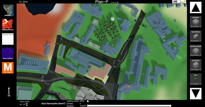
Plan P can also be used individually but it is essentlially a workshop tool. Quick suggestions can be easily sketched up during the workshop, and provide a base for discussion about different alternatives. The tool itself is easy to use and visually understandable (including a bird’s eye view and a street level view). The tool is not meant to be used for creating actual detailed plans, which require professional skills and tools, but to visualize visions and generate discussion.
Plan-P has been developed for a year now. There are many plans for the future, for example including a functionality to import city models in the standard CityGML format. In addition to new plans, city models of existing plans could also be imported or recreated using Plan-P’s building functionality. After that they could be compared and finally exported back to CityGML format to be used in other city planning processes. Thus far different versions of Plan-P have very basic 3D city models of Pasila (Helsinki), Otaniemi campus (Espoo) and Pansio dock (Turku), but more areas could be quite easily created from existing 3D data as it becomes available.
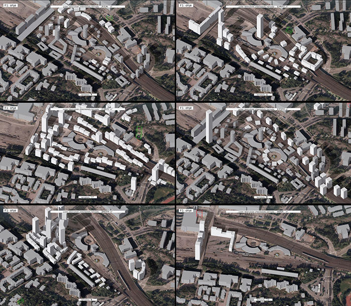
Results of a participatory urban planning workshop for Southern Central Pasila area using Plan-P (organized by Dodo ry and Petri Kangassalo).
One goal for Plan P development is to be able to visualize the impacts of a city plan – how much land buildings require, built area efficiency, energy use, traffic, supporting area needed for food production, and other environmental impacts as demonstrated in another application developed in ABE as a course project. In the future, the aspect of impact evaluation could be also be developed further.
All in all, Plan P could facilitate the participation of non-professionals in the urban planning process. Also, impact evaluation would be included in the discussion more naturally as it could be covered with the same tool. This in line with the goals of ABE: supporting decision making and developing ways to collaborate with a wide group of stakeholders.
More info on the development of the tool is available on the Plan-P development blog.